Solution Smart mapping
Location Intelligence
Transform raw location data into actionable insights. Analyze patterns, predict trends, and make data-driven decisions with advanced geospatial intelligence tools.
Learn moreCartography
Scalable and customizable maps for your websites and applications. Choose from our optimized themes and integrate easily with our APIs and SDKs.
Create a free account
Map Themes
Three carefully designed map themes to fit all your needs.
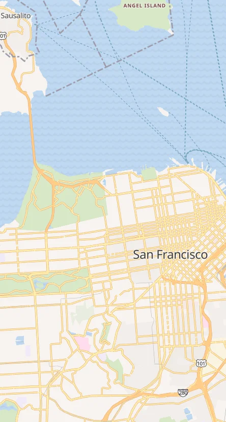
Clean, clear, and beautiful map tiles for visualizing anything. Themes that highlight roads, boundaries, and labels for easy navigation and understanding.
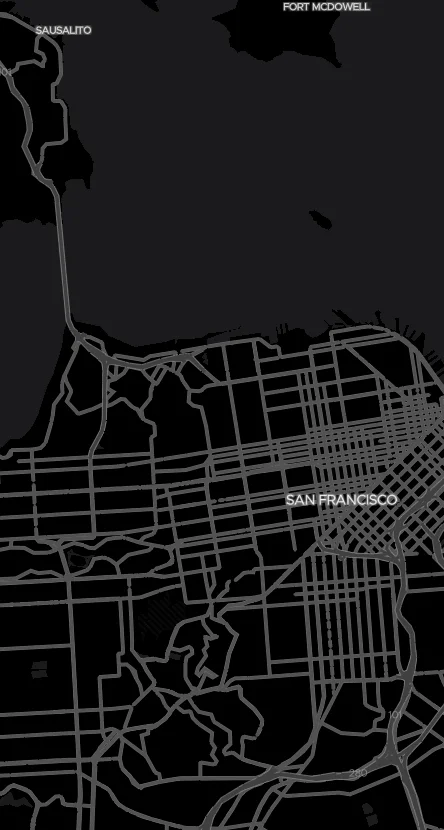
Designed from the ground up to be easy on the eyes, this theme offers a perfect balance of comfort and visibility for nighttime or low-light environments.
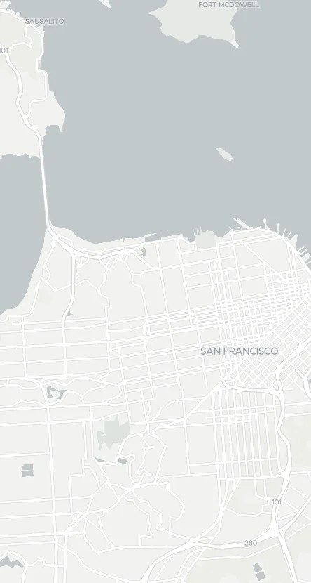
A harmonious blend of clarity and information, Light mode excels at presenting dense data points while keeping the map visually appealing and easy to read.
Use Cases
Discover how businesses use TMaps to power their location-based services and applications.
Transform raw location data into actionable insights. Analyze patterns, predict trends, and make data-driven decisions with advanced geospatial intelligence tools.
Learn moreExperience unmatched precision with our detailed coverage of Tunisian regions. From Ben Arous to every corner of Tunisia, get accurate street-level data.
Learn moreVisualize complex datasets with powerful mapping tools. Create heatmaps, cluster analysis, and custom overlays to understand your data at a glance.
Learn moreApplications
Explore the most popular use cases for interactive maps across different industries.

Optimize delivery routes, track vehicles in real-time, and reduce operational costs with smart routing algorithms.

Display properties on interactive maps, show nearby amenities, and help buyers visualize locations.

Connect drivers and passengers with accurate location tracking, ETA predictions, and optimal pickup points.

Help customers find your nearest locations with interactive store finders and direction services.

Manage field teams efficiently with territory mapping, job assignment, and real-time workforce tracking.

Create engaging travel experiences with interactive maps showing attractions, hotels, and recommended routes.
Features
Everything you need to create exceptional mapping experiences.
Easily integrate high-resolution fixed maps for print, emails or web pages. Maximum resolution of 2048x2048 pixels.
Real-time visualization with JavaScript and Mobile support for dynamic mapping experiences.
Display up to 50,000 markers with automatic clustering for optimal performance.
Heatmaps and territorial analysis to track your fleet and visualize your data.
Maps FAQ
Find answers to the most common questions about our mapping services.
We offer static maps (PNG, JPEG, SVG, PDF) for simple integration and dynamic JavaScript maps for interactive experiences. You can fully customize the appearance and features through our APIs.
For dynamic maps, use our JavaScript SDK by including the library, initializing with your API key, and customizing as needed. For static maps, simply use our API URL to display the map image.
You can customize colors, styles, icons, labels, and map themes. Our online design studio allows you to create maps matching your specific branding and visual identity requirements.
Static maps support a maximum resolution of 2048x2048 pixels. Dynamic maps support up to 50,000 markers with automatic clustering to maintain performance even with thousands of data points.