API Lookup
Reverse geocoding
Converts coordinates into human-readable addresses. Breaks addresses into street, city, state, etc., supports multilingual responses, and allows query filters.
DemoGeocoding
Easily convert addresses to coordinates and vice versa with our robust and scalable geocoding APIs. Multilingual support and accurate results for all your location needs.
Create a free account
Geocoding services
From forward/reverse lookups to POI search and timezone insights, every API is tuned for performance.
Converts coordinates into human-readable addresses. Breaks addresses into street, city, state, etc., supports multilingual responses, and allows query filters.
DemoTransforms plain-text addresses into coordinates with element-aware parsing that understands street, city, and state, plus language and filter controls.
DemoOffers instant suggestions as the user types, matching whole words or substrings. Includes plugins for easy implementation.
DemoReturns points of interest (fuel stations, ATMs, restaurants, etc.) and custom place lists around a given coordinate.
DemoUnderstand the current time at any point and retrieve offset data for locations across the world.
Demo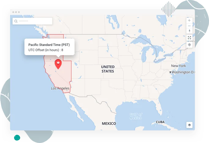
Use Cases
Real implementations that combine maps, routing and addresses so teams can act on location intelligence.

Turn geolocation into a competitive advantage with TMaps Addresses, Maps and Routing APIs that keep every critical resource visible.

Craft delightful web or mobile location experiences with address, map, and routing APIs that stay fast under load.

Leverage TMaps geolocation APIs to give meaning to the “where” in your data and power richer analytics.
Geocoding FAQ
Answers to the most common questions about our geocoding APIs.
Geocoding is the process of converting addresses into geographic coordinates (latitude, longitude) and vice versa.
Our API supports forward and reverse geocoding, autocomplete, nearby points-of-interest search, and timezone retrieval.
Yes, our API is built for both web and mobile with optimized performance and comprehensive documentation.
Autocomplete analyzes user input in real time and returns matching suggestions in a dropdown, simplifying address or place entry.